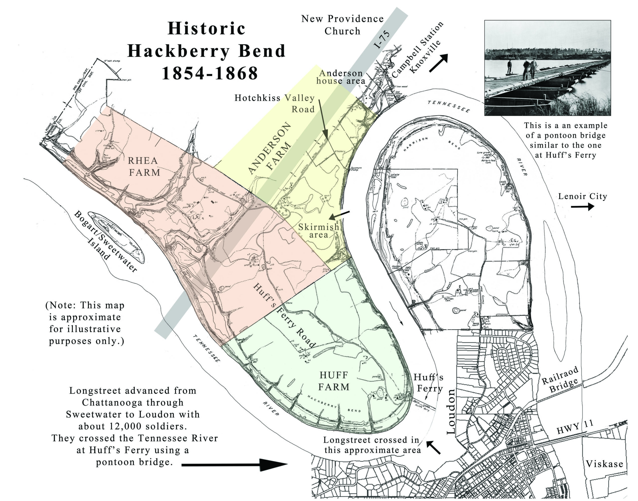
The historic community of Hackberry Bend began in 1854 when Joseph Anderson petitioned the US government to have a post office in his dry goods store. Joseph died in 1865, and his son Samuel ran the post office until 1868. Hackberry Bend is listed on the 1860 and 1880 census records. In 1870, Loudon County was created from parts of Roane, Blount, and Monroe Counties. So, everything in the newly formed county was lumped under Loudon (incorrectly transcribed as London) on the 1870 census.
On November 13 and 14, 1863, CSA General James Longstreet and 12,000 to 15,000 troops crossed the Tennessee River near Huff’s Ferry, which went from the town of Loudon to Hackberry Bend. He was on his way from Chattanooga to Knoxville to engage USA General Burnside’s troops at Fort Sanders. This map roughly shows the area of Hackberry Bend, although anyone who got their mail from the post office would have been considered part of the community. Those receiving their mail in Loudon, including the Huff family who ran the Ferry, would not have appeared on the census under Hackberry Bend.
